118522/159472

 Download Photo
)
)
)
)
)
)
)
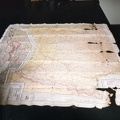
Clarence Wieseckel's map on which he traced the road he followed from Belgium to Switzerland by foot with another downed airman, Donald Toye.

- Created on
- Sunday 29 March 2009
- Posted on
- Sunday 29 March 2009
- Dimensions
- 1104*1662
- File
- Carte_soie_Wieseckel.jpg
- Filesize
- 429 KB
- Albums
- Visits
- 2523
0 comments